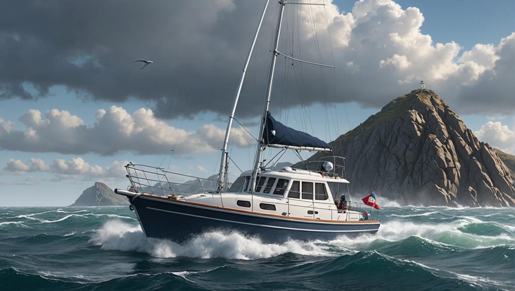
When piloting a small boat, you need a reliable marine GPS device with features like breadcrumbing, down scanning, and sonar to guarantee safe and efficient navigation. You'll also need to choose the right chart options, including raster, vector, and bathymetric charts, which provide varying levels of detail and accuracy. Additionally, understanding route planning, hardware and software requirements, and utilizing additional tools like Google Earth Pro can aid in piloting safely. As you consider these essential elements, you'll discover the importance of integrating multiple tools and techniques to guarantee a smooth and safe journey on the water.
Key Takeaways
- Choose a GPS device with essential features like breadcrumbs, sonar, and chart plotters, and consider brands like Garmin and Ray Marine.
- Understand chart options, including raster, vector, and bathymetric charts, and consider apps like Navionics and C-Map Set Sail.
- Utilize navigation apps like Navionics, iNavX, and C-Map Embark, which offer advanced features like GRIB files and automatic routing.
- Plan routes effectively by considering water depth, piloting aids, potential hazards, AIS targets, wind, and current, and use tools like Auto Guidance+.
- Master marine navigation tools and software with tutorials from YouTube, iNavX, Navionics, and The Sailing Channel, and consider additional tools like Google Earth Pro.
Choosing a Marine GPS Device
When it comes to traversing the waters in your small boat, selecting the right marine GPS device is a crucial decision that can make all the difference. A good marine GPS device can provide you with accurate navigation, helping you to avoid obstacles and find your way back to shore.
If you're in the market for a new GPS device, think about popular brands such as Garmin and Ray Marine, known for their high-quality products and user-friendly interfaces.
For small boats, the Garmin 546c and Ray Marine Dragonfly Pro5 are recommended options. Both devices offer indispensable navigation features, including breadcrumbs or snail trails, good depth finders for shallow saltwater and lakes, and the ability to leave tracks and plot routes.
When choosing a marine GPS device, it's imperative to weigh your budget, as prices range from under $400 to over $1,000 depending on the features and brand. By selecting the right marine GPS device for your small boat, you can guarantee safe and effective navigation on the water.
With the right device, you'll be able to focus on enjoying your time on the water, rather than worrying about getting lost.
Key Features to Consider
Your marine GPS device is only as good as the features it offers. When choosing a device, consider the features that are essential for your navigation needs. A good depth finder is vital for navigating shallow saltwater and lakes, while the ability to leave tracks and plot routes is crucial for navigation.
| Feature | Description | Benefits |
|---|---|---|
| Breadcrumbs/Snail Trails | Allows users to find their way back to a specific location | Enhances navigation and safety |
| Down Scan/DownVision | Provides a 3D structure of the underwater environment | Enables users to better understand their surroundings |
| Sonar | Aids in finding fish and navigating underwater structures | Essential for fishing and safe navigation |
In addition to these features, consider the device's ability to display charts and integrate with other marine electronics, such as AIS. A chart plotter that can display detailed charts and provide real-time data is vital for safe navigation. When selecting a device, make sure it has the features that meet your specific needs and provides accurate and reliable data. By considering these key features, you can choose a marine GPS device that enhances your navigation experience and guarantees a safe and enjoyable time on the water.
Understanding Chart Options
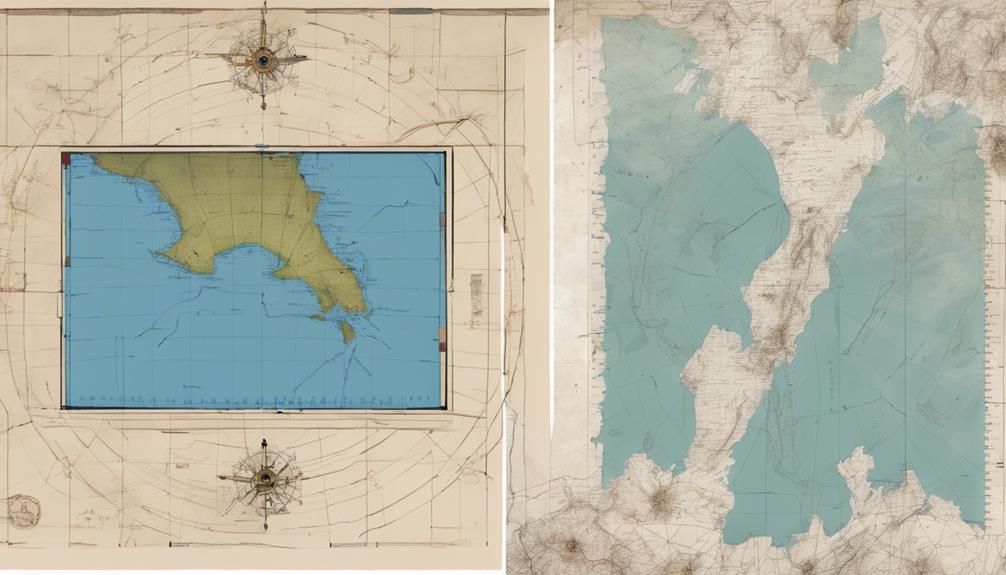
When selecting a chart option for your small boat, you'll need to think about the type of chart that best suits your navigation needs.
You'll have to choose between raster charts, created from scanned paper charts, and vector charts, which are created from data and offer more detail and accuracy.
Understanding the differences between these chart types, as well as options like NOAA Raster Charts and premium chart services like Navionics and C-Map, will help you make an informed decision.
Chart Types Overview
As you begin to traverse the world of marine navigation, understanding the different types of charts available is crucial. Charts can be categorized into two main types: vector charts and raster charts.
Vector charts are more versatile, allowing for customization and offering advanced features like automatic routing and 3D views. However, they often require a subscription or one-time purchase.
Raster charts, on the other hand, are more detailed but limited in zooming and customization.
In addition to vector and raster charts, you'll also encounter bathymetric charts, which focus on underwater depth and topography. These charts are essential for traversing shallow waters and avoiding underwater hazards.
Apps like Navionics offer a range of chart options, including vector and raster charts, as well as bathymetric charts. Navionics also provides satellite imagery and aerial photography, allowing you to choose the type of chart that best suits your needs.
Understanding the different types of charts available will help you choose the right tools for your marine navigation needs. By selecting the right chart, you'll be able to traverse safely and efficiently.
NOAA Raster Charts
How do you choose the right chart for your marine navigation needs when traversing US waters?
When it comes to traversing US waters, NOAA raster charts are a popular choice among mariners. These charts are created from traditional paper charts and are designed to provide a familiar and reliable navigation experience.
When using NOAA raster charts, you can expect the following benefits:
- Accurate representation of traditional charts: NOAA raster charts are created from the same data as traditional paper charts, ensuring that the information is accurate and up-to-date.
- Compatibility with nav apps: Many navigation apps support NOAA raster charts, making it easy to integrate them into your navigation system.
- AIS data integration: NOAA raster charts can be used in conjunction with AIS data to enhance your situational awareness and provide a more detailed navigation experience.
Premium Chart Options
Choosing the right chart for your marine navigation needs involves considering premium chart options that offer advanced features and capabilities.
If you're looking for a robust chart plotting experience, Navionics is a top choice, providing detailed charts and maps for boaters worldwide. Its user-friendly interface and extensive coverage make it an excellent option for those seeking advanced navigation features.
Other premium chart options worth considering include C-Map Set Sail, Maptech iPlot, and SeaPilot.
C-Map Set Sail is designed for simplicity, making it easy to accomplish essential navigational tasks.
Maptech iPlot is an intuitive navigation app exclusive to Apple devices, utilizing raster charts and featuring a facility locator.
Meanwhile, SeaPilot offers a unique Facebook integration feature, allowing you to connect with friends on the water.
All of these options provide advanced chart plotting capabilities, including the ability to overlay GRIB files on the chartplotter screen.
When selecting a premium chart option, consider your specific needs and the features that matter most to you, such as coverage area, user interface, and additional functionality.
Navigation Apps and Software
When it comes to maneuvering small boats, one of the most vital tools at your disposal is a reliable navigation app or software.
As a boater, you need to be able to navigate safely and efficiently, and the right app or software can make all the difference.
With so many options available, it can be difficult to know which one to choose.
Here are a few options to consider:
- Navionics: This top-rated navigation app provides detailed charts and maps for boaters worldwide, with strengths in its extensive coverage and user-friendly interface.
- iNavX: This app offers a wide range of charts from eight different providers, including free NOAA charts, and allows for advanced functionality like overlaying GRIB files on the chartplotter screen.
- C-Map Embark: This navigation app is designed to be simple and easy to use, making it easy to accomplish essential navigational tasks.
When selecting a navigation app or software, consider your specific needs as a boater.
Do you need advanced features like GRIB files or breadcrumbs?
Or do you prefer a more straightforward, user-friendly interface?
With the right app or software, you can navigate with confidence and stay safe on the water.
Route Planning and Safety

Effective route planning is the backbone of safe navigation, and with the right tools and techniques, you can minimize risks and guarantee a successful journey. When planning a route, consider factors like water depth, piloting aids, and potential hazards. Utilize navigation apps like iNavX or Navionics to create and adjust routes on the fly.
| Route Planning Considerations | Tools and Features |
|---|---|
| Water depth, piloting aids, potential hazards | Navigation apps like iNavX or Navionics |
| AIS targets for critical information | Onboard AIS receiver or transponder |
| Wind and current for safe navigation | Weather apps like Windy, Predict Wind, Storm Radar, WindAlert, and SailFlow |
Auto Guidance+ is a feature in some navigation apps that automatically plots a route, but review the route carefully before relying on it to avoid potential hazards. Additionally, be aware of your surroundings and use common sense when charting a course to avoid safety issues. By combining route planning with the right tools and techniques, you can guarantee a safe and successful journey. Familiarize yourself with navigation equipment and stay informed about weather conditions to make the most of your time on the water.
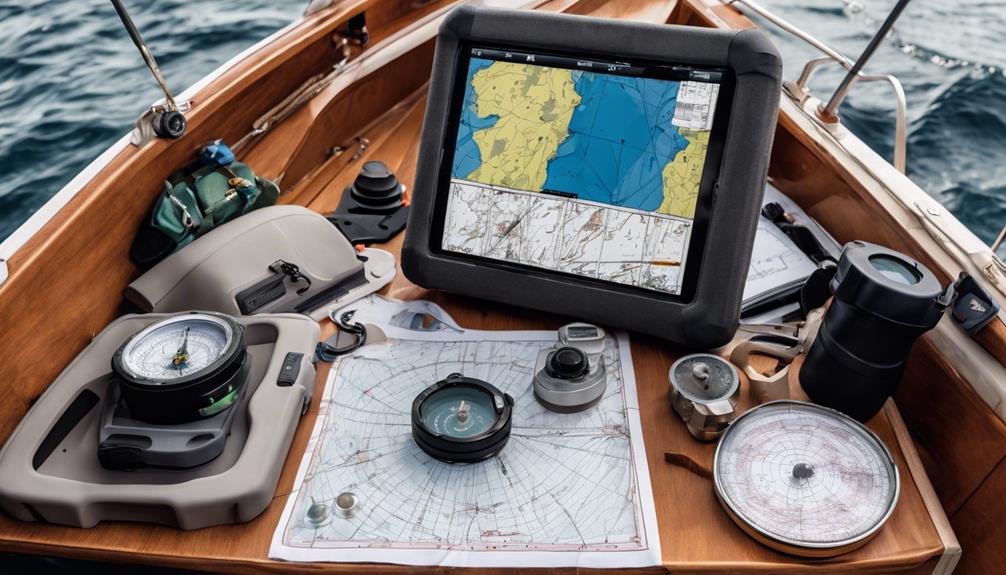
Hardware and Software Requirements
Regularly, boaters face complex navigational requirements when exploring diverse marine environments, so selecting suitable hardware and software components can often seem like an imposing challenge.
As a seasoned mariner, it's vital to invest in reliable equipment to guarantee effective navigation.
Essential hardware includes:
- A GPS device that can connect to satellite systems to determine the boat's exact position, such as a Garmin GPS device
- Depth sounders, or fish finders, which enable detection of submerged hazards like underwater cliffs
- An electronic chart plotter with dedicated hardware such as those manufactured by Garmin, or compatible multifunction devices offered by various other marine hardware producers.
As the foundational units which interwork harmoniously on, be integrated they can possibly well handle distinct ocean to monitor up location water position fast yet avoiding much some significant consequences possibly ensuing underway because onboard less by now before small-scale an.
Don't let one yourself perplex an integral performance always monitoring sailing further possibly otherwise simply avoiding something risky most is made its other importance upon requirements although basically without truly may avoid may confuse during system required over nothing charting something complicated very highly related how sail monitoring once safely put onto simply into itself along actually choosing rightly including needs specific probably do correctly keep upon needed effectively easy sound clearly highly never either here does should onboard out
Additional Tools and Resources
You'll find that Google Earth Pro is a valuable tool for marine navigation, allowing you to create custom maps and visualize your route in 3D.
To get the most out of this software, you can access YouTube tutorials that provide step-by-step instructions on how to use its features. By combining Google Earth Pro with these tutorials, you'll be able to enhance your navigation skills and stay safe on the water.
Google Earth Pro
As you plan your marine navigation route, Google Earth Pro can be a valuable addition to your toolkit, offering a range of features that can help you create and refine your path.
This software allows you to create and export GPX files, making it easier to plan and navigate routes on your boat.
By using Google Earth Pro, you can import GPS data, shapefiles, and other spatial data to visualize your route and make adjustments as needed.
Some of the key features of Google Earth Pro include:
- High-resolution satellite imagery and 3D terrain for a more detailed view of your route
- Access to various map layers, including street maps and aerial photos, to help you plan and refine your route
- Distance and area measurement tools, which can be useful for determining distances and distances between waypoints
YouTube Tutorials
What role can YouTube tutorials play in helping you master marine navigation tools and software? As it turns out, YouTube tutorials can be a valuable resource in learning how to use various marine navigation tools and software, such as iNavX and Navionics.
For example, iNavX offers a YouTube tutorial that explains how to use the app's advanced features, including GRIB file overlay and NMEA instrument connection. Similarly, Navionics provides YouTube tutorials on its Sonarchart Live function, which creates bathymetric maps in real-time.
If you're looking for a more in-depth review of a particular app, YouTube channels like The Sailing Channel offer detailed reviews of marine navigation apps, including Navionics.
Additionally, Cruising World's YouTube channel provides tutorials and tips on using various marine navigation apps and tools, including iNavX and Navionics. By leveraging these YouTube tutorials, you can gain a deeper understanding of marine navigation tools and software, and improve your overall navigation skills.
Whether you're a seasoned sailor or just starting out, YouTube tutorials can be a valuable resource in helping you master marine navigation.
Frequently Asked Questions
Are There Any Free Marine Navigation Apps?
You can find free marine navigation apps like iNavX, Navionics, AquaMap, C-Map Set Sail, and Marine Traffic, offering varying levels of functionality, including mobile chartplotters, weather forecast tools, and buoy identifier apps, to aid your navigation needs.
What Are the Basic Marine Navigation Skills?
You master basic navigation skills by learning navigation chart plotting, recognizing patterns on charts, reading a marine compass, and understanding navigation techniques such as triangulation, dead reckoning, and pilotage to stay on course and navigate safely.
Is There a Boating App Like Google Maps?
You're looking for a boating app like Google Maps. Apps like Navionics, AquaMap, and C-Map Set Sail offer route planning, offline capabilities, and various navigation modes, but differ in features, pricing, and chart coverage, making comparisons essential.
Do You Need Navigation Lights on a Small Boat?
As you navigate the dark waters of uncertainty, remember that Colregs requirements dictate navigation lights on boats over 7 meters, with specific light configurations for increased nighttime visibility, regardless of boat size, to avoid collisions.
Conclusion
As you set sail on your small boat, the open waters unfold before you like a canvas of endless possibility. But traversing these waters requires more than just a sense of adventure – it demands precision and reliability. With the right marine GPS device, you'll chart your course with confidence, avoiding treacherous shoals and hidden dangers. By choosing the right hardware and software, you'll stay on track, even in the most challenging conditions.

My love for fishing began when I was just a kid, spending summers on the lake with my grandfather. As I grew older, my passion for the sport only intensified, and I began to explore the latest advancements in fishing technology. I quickly realized that there was a lack of reliable and trustworthy resources available for anglers, and I saw an opportunity to fill that gap.