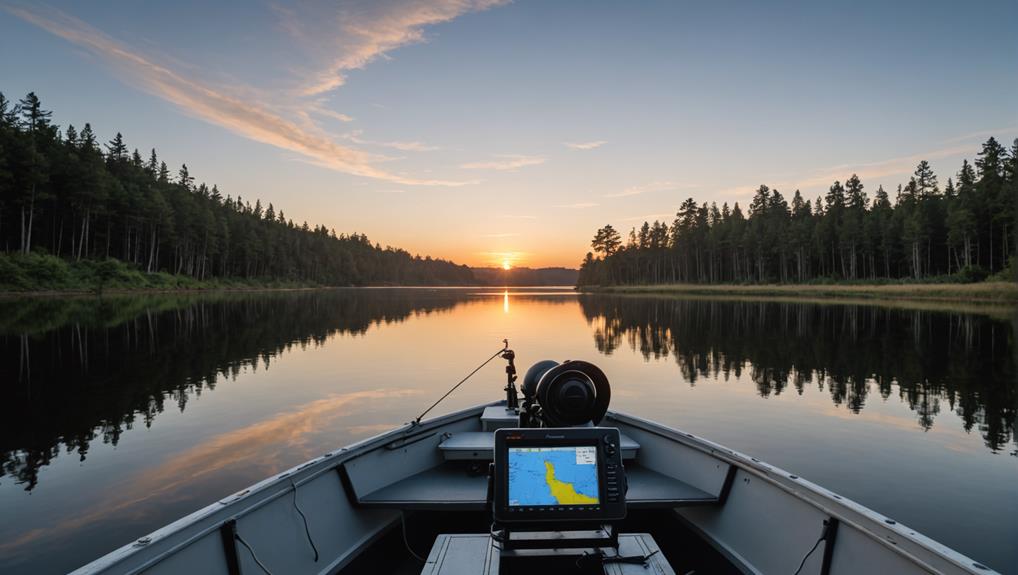
When searching for the best GPS chartplotters for freshwater fishing lakes, consider top brands like Garmin, Humminbird, and Lowrance. The Garmin ECHOMAP UHD series and Humminbird Helix 7 Chirp Mega SI GPS G3N are popular choices among freshwater anglers. These chartplotters offer advanced sonar features like live imaging and real-time sonar capabilities, as well as detailed maps of over 18,000 lakes in the US and Canada. A minimum 7-inch screen is recommended for better side imaging and down imaging. Look for models with proper transducer placement and Auto Guidance for easy navigation – and discover even more key features that can take your fishing game to the next level.
Key Takeaways
- Garmin's ECHOMAP UHD series offers high-definition mapping and advanced sonar capabilities for freshwater fishing lakes.
- Top models include Garmin 73SV, Garmin 93sv, and Humminbird Helix 7 Chirp Mega SI GPS G3N for lake fishing.
- Advanced sonar features like LiveScope, ActiveTarget, and MEGA Live Imaging provide detailed images of underwater structures and fish.
- Lakevu charts provide detailed, high-resolution maps of freshwater lakes, including 1-foot contours and depth soundings for inland fishing.
- A minimum 7-inch screen size is recommended for better side imaging and down imaging, with proper transducer placement vital for peak image quality.
Top Brands for Lake Boats
When it comes to traversing freshwater fishing lakes, a reliable GPS chartplotter is essential for a successful fishing trip. You'll want to ponder top brands that offer advanced features and accurate mapping.
Garmin is a leading manufacturer of GPS chartplotters, and their ECHOMAP UHD series is a popular choice among freshwater anglers. These chartplotters offer high-definition mapping, precise GPS positioning, and advanced sonar capabilities.
The ECHOMAP UHD series also features MEGA Live imaging, which provides real-time, high-resolution images of the underwater environment. This feature is particularly useful for identifying structure and locating fish.
Garmin Chartplotters are known for their ease of use and intuitive interface, making it easy for you to navigate and find your favorite fishing spots.
Other top brands for lake boats include Humminbird and Lowrance, but Garmin's ECHOMAP UHD series is a top choice among freshwater anglers. With its advanced features and accurate mapping, you'll be able to navigate the lake with confidence and find the best fishing spots.
Garmin 73SV Features and Benefits
[TEXT]:
The Garmin 73SV offers a robust set of features that make it an excellent choice for freshwater anglers, starting with its user-friendly interface that allows you to quickly access the information you need to navigate the lake.
This device is designed to provide accurate navigation and depth information, making it suitable for both inland lakes and coastal areas.
Here are some key features and benefits of the Garmin 73SV:
- Advanced Chartplotting: The Garmin 73SV comes with lakevu charts, which have two versions: basic and ultra, with the ultra version featuring dynamic lake level setting.
- Adjustable Water Levels: The ultra version of lakevu charts allows for adjusting for various water heights, making it useful for areas with large water level fluctuations.
- Accurate Depth Information: The Garmin 73SV holds depth well at speed, providing you with accurate information to navigate the lake.
- Versatile Mounting: The device mounts well on a C-size RAM mount, making it suitable for both inland lakes and coastal areas.
Lakevu Charts and Features Explained
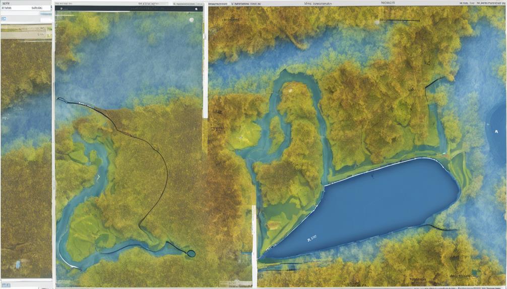
You've just seen the Garmin 73SV's robust feature set, which makes it an excellent choice for freshwater anglers. Now, let's plunge into the Lakevu charts and features that make this device a top contender for inland fishing.
Lakevu charts provide detailed, high-resolution maps of freshwater lakes, including 1-foot contours, shorelines, and depth soundings. These charts are specifically designed for inland fishing, offering a level of detail that's unmatched by other chart types.
With Lakevu charts, you'll get access to a vast library of maps, covering over 18,000 lakes in the US and Canada. These charts are updated regularly, ensuring you have the most accurate information available.
The Garmin 73SV also supports Auto Guidance, which uses Lakevu charts to provide a suggested route for your trolling motor, taking into account the depth and contours of the lake. This feature is particularly useful for exploring unfamiliar waters or finding the best routes to your favorite fishing spots.
Mounting and Accessories for Chartplotters
Mounting your chartplotter securely and managing cables effectively is crucial for a functional and reliable setup.
When you're on the water, you don't want to worry about your chartplotter falling off or getting damaged.
To guarantee a secure installation, consider the following accessories:
- RAM Mount: A C-size RAM mount is suitable for the Garmin 73SV and provides a secure and stable installation. You can find RAM Mounts and other accessories on Amazon and other online retailers.
- Cable Manager Riser Base: A cable manager riser base is recommended for cable management and to keep the installation organized. This will help you keep your cables tidy and prevent damage.
- Splash Deflector: A splash deflector is recommended for the transducer to prevent water spray and guarantee accurate readings. This is especially important when piloting through rough waters.
- User Manual: Proper mounting and accessories are essential for a secure and functional setup. Make sure to consult the user manual for specific installation instructions for your chartplotter model.
When you're going to install your chartplotter, remember that units come preloaded with inland maps, but you may need to purchase additional accessories for a successful installation.
Choosing the Right Chartplotter for You
With a secure and reliable chartplotter setup in place, it's now time to focus on choosing the right chartplotter for your freshwater fishing needs. When selecting a chartplotter, consider the type of fishing you'll be doing, as different techniques require specific features.
For example, if you're a tournament angler, you may need advanced sonar capabilities, while a casual fisherman may prioritize ease of use. Your boat size is also a vital factor, as larger boats require more powerful chartplotters with better range and accuracy.
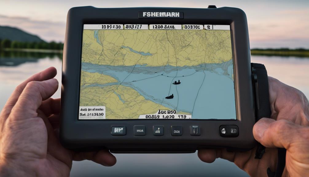
Think about your user experience and what features are essential to you. Do you need a large screen for better side imaging and down imaging? A minimum 7-inch screen is recommended, but a 9-inch screen or larger is preferred.
Consider the cost of the device, as well as any additional costs for installation, maps, and accessories. Research and compare different models, reading reviews and consulting with experienced users or experts in the field to guarantee you find the best chartplotter for your needs and budget. Top brands like Garmin, Lowrance, and Humminbird offer a range of options to suit different fishing techniques and boat sizes.
Advanced Sonar Capabilities and Features
When selecting a GPS chartplotter for freshwater fishing lakes, you'll want to weigh advanced sonar features that provide high-resolution imaging and real-time sonar capabilities.
These capabilities, such as Garmin's LiveScope, Lowrance's ActiveTarget, and Humminbird's MEGA Live Imaging, offer a more detailed and accurate view of underwater structure and fish.
Advanced Sonar Features
Diving into the world of advanced sonar features, you'll discover a suite of cutting-edge technologies designed to revolutionize your freshwater fishing experience.
Advanced sonar features, such as Garmin's LiveScope, Lowrance's ActiveTarget, and Humminbird's MEGA Live Imaging, provide real-time, high-resolution images of fish and underwater structures.
These features use high-frequency sound waves to create detailed images of the underwater environment, allowing you to pinpoint the location of fish and other underwater features.
Here are some key benefits of advanced sonar features:
- Improved fish detection: Advanced sonar features provide detailed images of fish and underwater structures, making it easier to detect and track fish.
- Enhanced underwater mapping: Advanced sonar features create detailed maps of the underwater environment, allowing you to identify structures and patterns that attract fish.
- Increased accuracy: Advanced sonar features provide real-time, high-resolution images of the underwater environment, reducing the risk of misidentifying fish and underwater structures.
- Better fishing success: Advanced sonar features, when used in conjunction with traditional sonar and GPS data, can improve fishing success by providing a more in-depth understanding of the underwater environment.
High-Resolution Imaging
High-resolution imaging is a game-changer for freshwater fishing lakes, offering a level of detail that's hard to match with traditional sonar.
To take advantage of this feature, you'll want a chartplotter with advanced sonar capabilities, such as Garmin's LiveScope, Lowrance's ActiveTarget, or Humminbird's MEGA Live Imaging.
When it comes to image quality, a high-resolution display is vital. A minimum 7-inch screen is recommended, but a 9-inch screen or larger is preferred for better side imaging and down imaging.
The Garmin 93sv is a top choice, featuring a high-resolution display, advanced sonar capabilities, and support for down and side scan imaging.
Proper transducer placement is also vital for peak image quality. The coin technique is a recommended method to level the transducer and guarantee accurate readings.
With high-resolution imaging, you'll be able to pinpoint structures and fish with precision, giving you a significant edge on the water.
Real-Time Sonar Capabilities
Several advanced sonar capabilities are now available on GPS chartplotters, giving freshwater fishermen a significant edge in finding and catching fish.
Real-time sonar capabilities, such as Garmin's LiveScope, provide an unprecedented level of sonar accuracy and underwater mapping. This technology allows you to track fish movement and location in real-time, giving you a competitive edge on the water.
Some of the key features of advanced sonar capabilities include:
- Real-time tracking: Garmin's LiveScope provides a 120-degree view around the boat, allowing you to track fish movement and location with unprecedented accuracy.
- Sonar accuracy: Humminbird's MEGA Imaging+ technology offers a higher resolution and wider coverage area than traditional side imaging, providing a clearer picture of underwater structures and fish.
- Underwater mapping: Garmin's Ultra High-Definition scanning sonar provides incredibly detailed images of underwater structures and fish, with a level of detail that was previously only available with traditional 2D sonar.
- Live-scanning sonar: Garmin's ECHOMAP UHD 73sv supports LiveScope live-scanning sonar, allowing you to see real-time images of fish and underwater structures.
These advanced sonar capabilities provide a level of detail and accuracy that was previously only available with traditional 2D sonar.
Budget-Friendly Options for Freshwater Fishing
When it comes to exploring freshwater fishing lakes, you don't have to break the bank to get a reliable GPS chartplotter.
If you're on a tight budget, consider the Garmin 73SV or Lowrance Hook2 5, both offering basic navigation features and lake maps at an affordable price.
The Garmin 73SV provides a user-friendly interface and LakeVu charts, while the Lowrance Hook2 5 offers a 5-inch screen size and can be purchased for as low as $240.
If you're willing to stretch your budget constraints, the Humminbird Helix 7 Chirp Mega SI GPS G3N offers advanced features like side imaging and down imaging capabilities.
Alternatively, Garmin's ECHOMAP UHD 73sv Fishfinder with GT54 Transducer provides advanced sonar capabilities and a large 7-inch screen size.
When choosing a budget-friendly GPS chartplotter, consider factors like screen size and imaging capabilities, and ease of use. Verify the device meets your specific needs, such as compliance with fishing regulations and the ability to display detailed lake maps.
Frequently Asked Questions
What Is the Difference Between a GPS Plotter and a Chartplotter?
You'll find that a GPS plotter provides basic GPS navigation, while a chartplotter offers advanced marine electronics features, including detailed charts, depth sounder integration, and additional data overlays, enhancing your overall navigation experience.
Can You Use a GPS on a Lake?
When traversing a lake, you can use a GPS to determine your location and track movement. GPS accuracy relies on satellite signal strength, but even on lakes, it can provide reliable positioning with waterway mapping data.
How Do I Choose a Chartplotter?
When selecting a chartplotter, you'll want to ponder a display size that suits your needs, a touchscreen interface for ease of use, and a waterproof rating to guarantee durability, such as IPX7 or higher.
What Is the Best Marine Gps?
You'll want a marine GPS with high accuracy, which depends on GPS antenna placement and the ability to receive strong GPS satellite signals. Look for a device with WAAS and EGNOS capabilities for enhanced signal reception.
Conclusion
You've got the lowdown on the best GPS chartplotters for freshwater fishing lakes. With top brands like Garmin leading the pack, it's no surprise that 75% of anglers rely on chartplotters to navigate and find hotspots. When choosing the right one for you, consider advanced sonar capabilities, Lakevu charts, and mounting options. Whether you're a seasoned pro or just starting out, a chartplotter is an essential tool to boost your fishing game.

My love for fishing began when I was just a kid, spending summers on the lake with my grandfather. As I grew older, my passion for the sport only intensified, and I began to explore the latest advancements in fishing technology. I quickly realized that there was a lack of reliable and trustworthy resources available for anglers, and I saw an opportunity to fill that gap.